Weather, tides…how should you consider the shipping forecast before you set sail? The shipping forecast is vitally important to maritime traffic of all kinds. It gives boaters a wealth of technical information to warn them of any adverse weather they might encounter. Unfortunately, it’s not that easy to decipher and understand meteorological data. Band of Boats gives you a detailed explanation concerning the data you need to know about.
1. Which elements need to be taken into consideration?
Wind
The wind comes from a low-pressure or anticyclonic system.
In a low-pressure system, the wind spins anticlockwise, with directions that tend to go in towards the centre of the low-pressure system.
On the other hand, when an anticyclonic flow occurs, the wind blows clockwise, with directions that tend to move away from the centre of the anticyclone.
On maps, the wind is represented by vectors (arrows), which may include telltales indicating wind speed, for example two telltales to represent wind at 20 knots.
Sea state
The sea state and the height of the waves in metres are also indicated in the weather bulletins.
The height of the swell in metres is also indicated, because that too can be dangerous. It is classified on the Beaufort scale from Force 0 (calm) to Force 12 (hurricane).
Precipitation
This is mentioned in weather reports as follows: fog, mist, drizzle, rain, snow, hail, showers, squalls, scattered showers, tornados, frost, and ice.
Sailing conditions can be difficult in squalls, and particularly without visibility.
They are represented by different colours on maps
Tides
Tide times are also indicated in weather forecasts. The low tide and high tide times are included, as well as the water heights. It is essential to have some idea of the water height before entering or leaving a port. The calculations are different according to the pressure: high or low.
For those equipped with electronic navigation software, they are represented by coloured triangular hourglasses. The tip of the triangle facing upwards means a rising tide. The tip facing down means a falling tide.
Tidal differences create the action of the current. It is easier to enter an estuary on a rising tide because the tide-related current carries the boat in the right direction.
The tidal current can be an excellent ally or a formidable enemy. You must therefore calculate your tide and have an accurate notion of what time the tide will turn.
2. What are the signs that foretell bad weather?
- A sudden fall in the barometer reading, which already indicates a low-pressure trend (below 1013 hectopascals) is a sign of impending bad weather.
- Visual observations can also help to predict bad weather: when the wind gradually turns southwards, turning anticlockwise, when the sky is filled with big, low clouds with vertical extensions (cumulus and cumulonimbus).
3. Where can you find information?
On the web
On the official METEO MARINE website: It is very easy to look up the weather on the internet.
There are many weather websites you can also look at because, according to their sources, they can confirm or rule out certain situations. It is interesting to compare the different websites to refine the predictions.
Do not hesitate to look up the weather several times in order to see how the situation is developing.
Harbour Master’s Office
Weather bulletins are posted in Harbour Master’s offices or printed out and available to sailors at the reception desk.
Signal stations
Signal stations can also give you meteorological information via VHF. Simply contact them on security channel 16. They will transfer you to another clearance frequency to inform you.
VHF
At sea, you can ask other ships, making sure they specify the date of the last weather bulletin (remember to keep the security channel clear).
Keep Channel 16 on stand-by to hear the bulletins broadcast regularly on clearance channels.
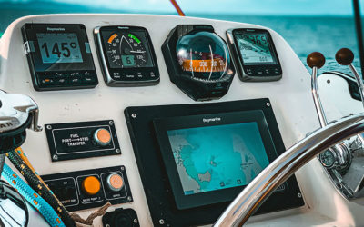
Certain navigation software packages can import weather maps freshly downloaded by a satellite telephone. This allows you to have very up-to-date reports.
Route planners are also available if you want to prepare for the next Vendée Globe.
It is therefore necessary to have an understanding of meteorology before going to sea. Just as you would before a mountain expedition.
It’s not enough to just look at the weather map; you need to study it carefully.
All the elements mentioned must be taken into account for your journey to go smoothly. Take advantage of periods of favourable weather to go out sailing, and postpone your trips in case of bad weather forecasts.
Many sailing clubs and marine professionals offer weather courses to upgrade your knowledge.
An example from Band of Boats: What do you see? …This is a low-pressure system off the Canary Islands, crossing the Atlantic with a wind-free zone to the right and a zone with 35-kt winds to the left.
We see isobars, with the middle one at 1008 hectopascals.
The blue arrows on the right specify the wind and its direction, and the red arrows indicate wind from 30 to 35 kt in the NORTH sector.